C-Map rolls out major cartography update for Europe
C-Map, a leader in digital marine cartography and cloud-based mapping and part of Navico Group, has announced a major update to its European charts. These updates include extended inland coverage for Northern France, over 200 new lakes for France, and improved high-resolution bathymetry and shaded relief across parts of coastal Europe and South Africa.
“We are excited to roll out this new update to our C-Map users in Europe, significantly transforming their navigation experience,” says Jakob Svensson, C-Map product manager. “Our cartography team is dedicated to sourcing new data and continually enhancing and improving our charts.”
The new data improves the Discover, Reveal and X Generation charts from C-Map and is available for free for anyone who has purchased a chart in the past year and subscribed to C-Map. The new charts are available to purchase now and customers can view the latest charts online.
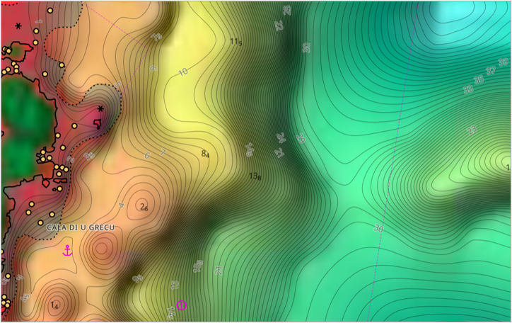
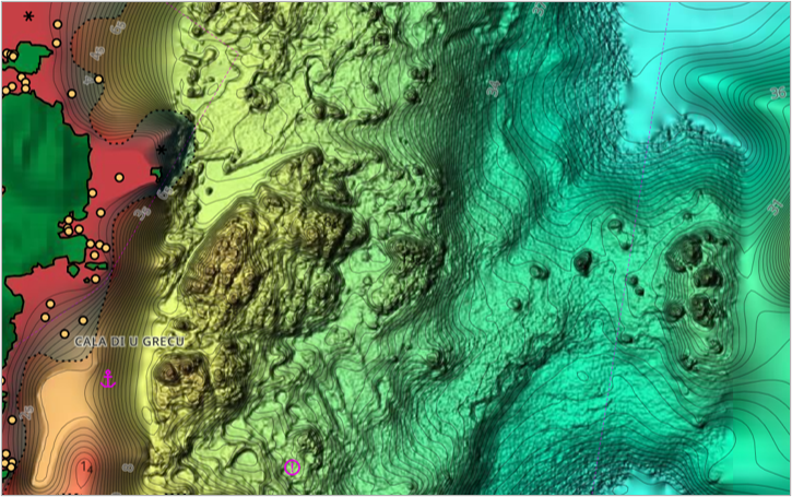
Image below showing Reveal charts of Bonafacio before (left) and after update (right).
Updates for European charts include:
- Improved high-resolution bathymetry and shaded relief across parts of coastal Europe including France, Italy, Spain, Portugal, and Belgium.
- Inland bathymetry and standard data improvements across Northern France and Netherlands including Canal Rijn, Nieuwe Rijn and others.
- Improved shorelines and updates to over 6,303 bridges and 1,100 locks across northern France inland waterways.
- Significant improvements to 230 French Lakes with new or improved shorelines, and new bathymetry including Lac d’Orient, Lac D’ Auzon amongst others.
- Standard updates, including updated information on marinas and port plans, Notice to Mariners (NTMs), latest ENC, and paper charts from official sources. Standard updates apply to all charts including Max, 4D, Discover, Reveal and X Gen charts within the EMEA portfolio.
The new updates are available now in Discover and Reveal, as well as Discover X and Reveal X charts, with shaded relief and satellite overlay only available in the Reveal product tiers.
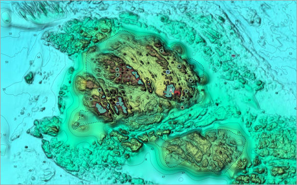 Reveal X Bretagne
Part of Navico Group, a division of Brunswick Corporation’s, C-Map is a leader in digital marine cartography and cloud-based mapping, offering one of the world’s largest marine navigation digital chart databases. C-MAP’s portfolio includes the Discover, Reveal and 4D chart ranges, which integrate with leading fishfinders and chartplotters, and via the C-MAP app available on the App Store and Google Play.
The post C-Map rolls out major cartography update for Europe appeared first on Marine Industry News.