SV Traversay III - North West passage/Cape Bathurst
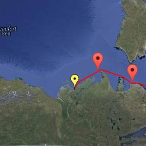
One of the unusual features of this summer's ice situation is the movement of Beaufort Sea ice in a kind of clockwise gyre to clutter up the coast of Banks Island. On a bad day, it even extends across the mouth of Amundsen Gulf to Cape Bathurst and impedes navigation between Tuktoyaktuk and the central arctic.
At the time we left Cambridge Bay, the Bathurst ice picture was bleak. Nonetheless, it began to look quite rosy as we headed west toward Pearce Point; there was less than 1/10 ice in a wide band around the cape. Of course gales have a way of changing the ice picture as we have noted before.
We left Pearce Point on the strength of an imperfect but still acceptable picture. We headed away into the fading winds and waves of the westerly gale mindful that the fair winds that followed would be brief. We used up much of this available interval when, in addition to the minimal speed we can maintain when powering into large waves, we discovered a 2 knot current flowing against us around Cape Parry. We were lucky to achieve 3 knots!
Shortly after our departure we received the "new" ice chart which showed Cape Bathurst had deteriorated to the extent of being surrounded by 2/10 ice backboned by a formidable wall of 4/10. But we were on our way and LIBELLELE had reported success in getting through.
For us, though, there would be a building easterly gale that would make a return to a safe anchorage very difficult if we failed to cross the ice barrier. Our ice chart would be 27 hours old when we reached the ice!
Various phone calls followed. On the one hand, LIBELLULE had succeeded and told us the route they had used. On the other hand, the government "Ice Operations Office" examined the latest RadarSat image and pronounced the ice impassable to us. We were loath to dash back to safe anchorage at Cape Parry without trying the ice and there wasn't time to get TO the ice and BACK to Cape Parry.
We hatched a plan! I bent on the storm sails and we decided that if the ice was impenetrable we would sail about to windward of the ice during the gale and see if things were better after: not a comfortable option, but it at least allowed us to continue with a good conscience.
At about this juncture, the official 1800UTC ice chart arrived in an email from David Lloyd. We were immediately relieved as it showed a difficult but passable situation.
In the event, it was all a bit anticlimactic. There were two or three ice barriers that took some searching to find a way through and, of course, countless VW Beetle sized chunks of ice bobbing about. Navigating in the ice was, in a way, pleasant; the ice damped out the waves normal to a gathering gale. We only really noticed the cold wind when we turned across our downwind course in search of a lead.
Now all that is behind us. 100 miles ahead is Tuktoyaktuk, our last NWP stop in Canada. Our government Sailing Directions authoritatively states that Tuk Harbour will be frozen over in the first week of October!
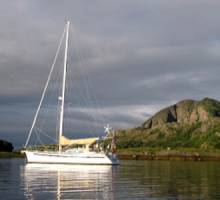
Position: 04/09/2013 03:10 (utc) 70°31.96'N 128°55.25'W. SV Traversay is a 43 steel sloop sailed by Mary Anne and Larry and they are sailing through the North West passage from east to west.


